

- Alhama de Murcia
-
+info
- • Festivities
- • Services Guide
- • The Craft
- • Gastronomy
- • Restaurants & Bars
- • Tourist Office
- • Brochures
- • News
- • Links of interest
- • Restaurants outside the town
- • Bars
- • Pubs and Coffee Shops
- • Coffee Shops and Ice-Cream Shops
- • Celebrations Hall
- • Bars with leisure centres for children
- • Take away food
- • Camping
- • Rural hostels
- • Holiday homes
- • El Berro


.jpg "https://www.youtube.com/watch?v=QJkTds8ouT4")
.jpg "https://www.youtube.com/watch?v=0KQjV92SVmE")

-
Destacados


.jpg "http://turismo.alhamademurcia.es/en/horarios-autobuses.asp")

.jpg "https://turismo.alhamademurcia.es/en/services-guide.asp")


.jpg "http://www.fiestadelosmayos.es/")
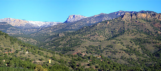
Paths of Sierra Espuña
- Path "Siete Hermanos", PR-MU 41
Itinerary: Point-to-point track.
Approximate Distance: 3.350 m
Approximate Time: 1 h. 10' without stopping
Starting Point: Visitors Centre "Ricardo Codorníu" 30S / X630943 / Y4191043
Arrival Point: Recreational area of “La Perdiz” 30S/ X630182/ Y4192494
Ascent Drop:106 m.
Descent Drop: 121 m.
Cartography: Esc. 1:25.000 of the IGN: 933-III Alhama de Murcia
- Path "Ricardo Codorníu", SL-MU 1
Itinerary: Circular route
Approximate Distance: 2.260 m
Approximate Time: 45 min. without stopping
Starting Pointand Arrival Point: Visitors Centre "Ricardo Codorníu" 30S / X630943 / Y4191043
Ascent Drop: 80 m.
Descent Drop: 80 m.
Cartography: Esc. 1:25.000 of the IGN: 933-IV Sierra Espuña; 933-III Alhama de Murcia.
- Path "La Umbría de Peña Apartada", PR-MU 59
Itinerary: Point-to-point track
Approximate Distance: 6.570 m
Approximate Time: 2 h. 30' without stopping
Starting Point:Visitors Centre "Ricardo Codorníu" 30S / X630943 / Y4191043
Arrival Point: Collado Bermejo 30S/ X626078/ Y4190899
Ascent Drop: 426 m.
Descent Drop: 121 m.
Cartography Esc. 1:25.000 of the IGN: 933-III Alhama de Murcia; 932-IV Sierra Espuña
- Path Valle de Leyva – Collado Mangueta, PR-MU 57
Itinerary: Point-to-point track
Approximate Distance: 7.950 m
Approximate Time: 3 h.without stopping
Starting Point: Recreational Area “La Perdiz” 30S/ X630270/ Y4192526
Arrival Point:Parking Collado Mangueta 30S/ X626078/ Y4192518
Ascent Drop: 635 m.
Descent Drop: 0 m.
Cartography: Esc. 1:25.000 of the IGN 933-III Alhama de Murcia.
- Path "Pedro López", PR-MU 63
Itinerary: Circular route
Approximate Distance: 16 km
Approximate Time: 5 h.without stopping
Starting Point y final: Parking Collado Mangueta 30S/ X626050/ Y4192530
Ascent Drop: 638 m.
Descent Drop: 638 m.
Cartography: Esc. 1:25.000 of the IGN 932-IV Sierra Espuña.
- Path of "El Berro", PR-MU 79
Itinerary: Circular route
Approximate Distance: 10,5 km
Approximate Time: 3 h. without stopping
Starting Point: El Berro, next to the Camping of Sierra Espuña 30S/X632630/Y4194672
Arrival point:The same (circular itinerary)
Ascent Drop: 297 m.
Descent Drop: 297 m.
Cartography: Esc. 1:25.000 of the IGN: 933-III Alhama de Murcia
- Path of "Gebas", GR-252.1
Approximate Distance: 11,23 km.
Approximate time: 4 or 5 hours walking
Starting point: Alhama de Murcia (Jardín de los Patos), 185 m. altitude.
Arrival point: Gebas (the viewpoint), 429 m. altitude.
Ascent and descent drop: 448 m
Cartography: Map 933-III of Alhama de Murcia; Es. 1:25000 of the IGN.
For more information you could visit www.carm.es/siga/senderos/index.html where you could find feature details about the paths of Sierra Espuña, as difficult, duration..
 Marked Paths of Alhama de Murcia
© 2024
Plaza de la Constitución, 10 Alhama de Murcia (Murcia)
Telf: 968 63 35 12 · Fax: 968 63 94 90
turismo@alhamademurcia.es
Diseño y programación: Avatar Internet S.L.L.
Plaza de la Constitución, 10 Alhama de Murcia (Murcia)
Telf: 968 63 35 12 · Fax: 968 63 94 90
turismo@alhamademurcia.es
Diseño y programación: Avatar Internet S.L.L.


